
Overview
Every feature type has a style and colour that control how its features draw on the map. However you may wish to override that general style to show data by a particular attrbute.
i.e. Colour by material type, condition, or location.
Setting style & colour
- Open Project Features and edit the feature type.
- Choose to edit the style

- Then choose the advanced styling buttonse

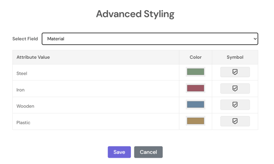
- Select a field to base the styling on from the list and it will auto populate the options available. You can edit the chosen style and symbol type by clicking in those fields.
⚠️ Note: To use advanced styling with data imported by .csv, .shp, .gdb, or .kml you can use the generate attributes button to extract the fields to be styled on.
ℹ️ This article covers feature geometry styling. For map text labels driven by attribute values, see Feature labelling.
What's next?