
Overview
The Soarvo Mobile App (Android and iOS) is the field-capture companion to the Soarvo web portal, used to capture geo-referenced features, photograph assets, and sync data back to the portal.
ℹ️ Who uses this: Team members with the Mobile-User or Mobile-Only role. Administrators, Project Managers, Project Supervisors, and Editors can also use the app.
What the Mobile App Does
- Capture features — point, line, and area features in your project's coordinate system
- Record GPS position — from the device or an external RTK rover
- Take photos and sketches — auto-watermarked with position and metadata
- Fill in attribute forms — utility inspections, tree surveys, and more
- Work offline — syncs to the portal when reconnected
- Integrate with external devices — RTK rovers, Trimble Catalyst, RD8K cable locators
Where Mobile Data Goes
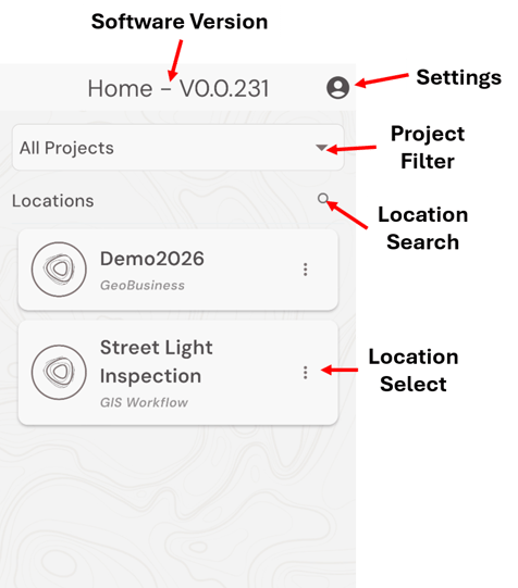
Every feature is associated with a Location in a Project. When a Project Manager shares a location with you, it appears in the app's list.
See How Soarvo Structures Data for the full hierarchy.
Getting Started in the Field
- Install Soarvo from the Google Play Store or App Store.
- Sign in with your portal credentials.
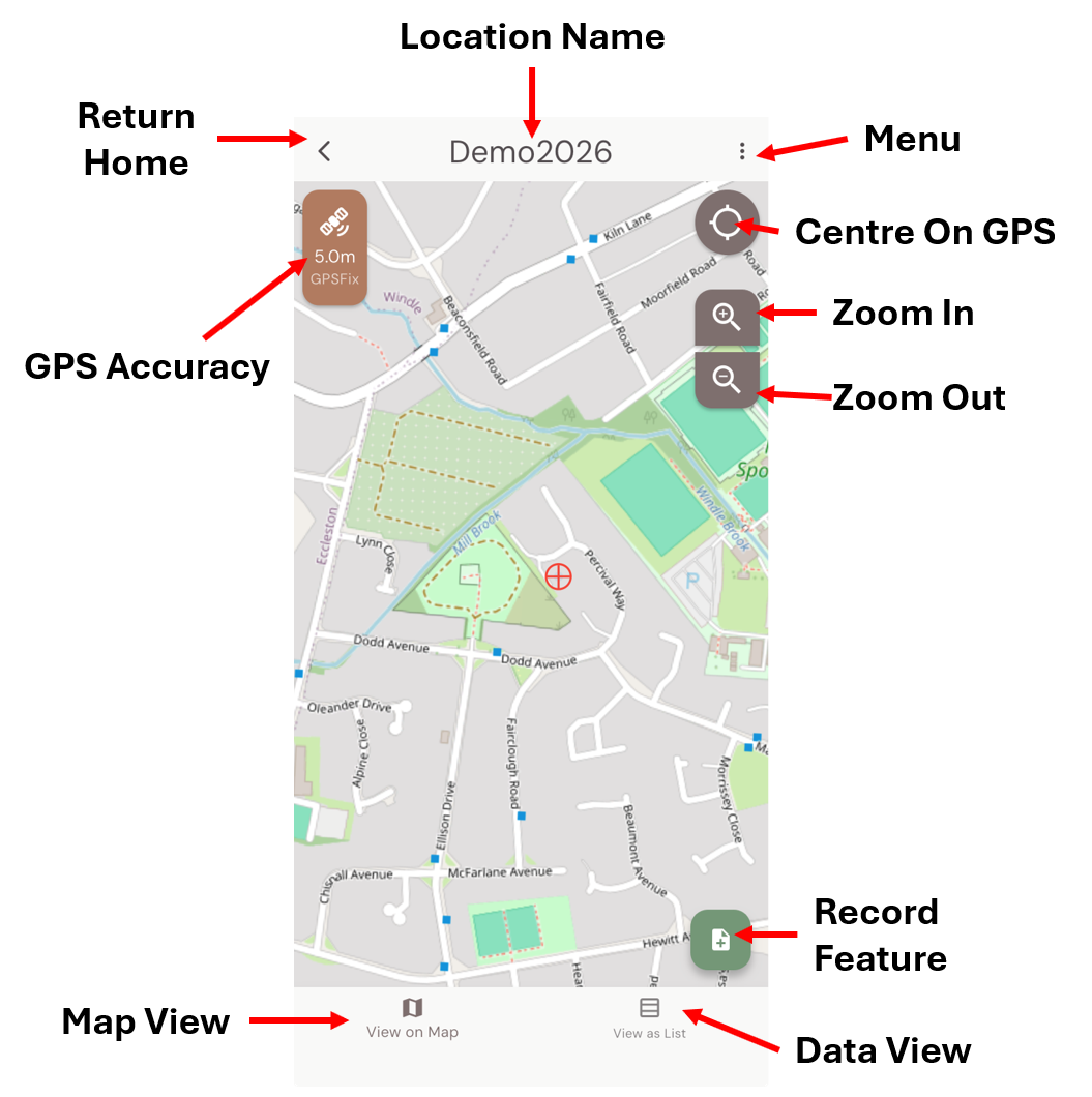
- Open a location. The map centres on your area.
- Tap + Record Feature (green button).
- Pick a feature type, place the geometry, fill the form, and save.
Mobile Screen Layouts:
Home Screen
Map Screen
What's Next?