
Overview
You can do spatial queries on GIS data based on attributes or location, and then carry out follow up activities.
To access the selection panel select it either from the Panels Button or from the Layers Panel for a specific dataset
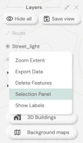
The Selection Panel view
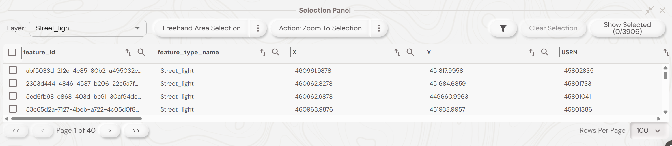
The selection panel allows you to filter and query any data in a selected layer.
Select the layer you wish to work on in the Layer box and then use the search button on each field to filter by certain attributes.
You can also filter the fields displayed within the selection panel with the filter button at the top of the panel.
To execute spatial queries the panel comes with 2 buttons - a mode button and an action button

The modes include:
-
Freehand Area Selection - draw a polygon on the map to select data
-
Freehand Line Selection - draw a line on the map to select data within a distance of it
-
Within An Existing Area - choose an existing polygon to select data within it
-
Along An Existing Route - choose a line on the map to select data within a distance of it
All of these functions will then select the records and highlight them on the map.
The actions include:
- Zoom To Selection - move the map over the highlighted records
- Assign To User - send selected data to a mobile app user
- Set Attribute - change an attribute for all selected records
- Delete Selection - delete selected records
- Export Data - export selected records as .CSV, .HTML, .DXF, .GeoJSON, .SHP
- Summarise - see number of records selected along with total length if linear features
You can clear the records selected with the Clear Selection button.