
Overview
Customise point cloud and 3D model display, and reposition data that doesn't align with the map.
Point Cloud Display Settings
Open the Panel Button to access Point Cloud Settings.
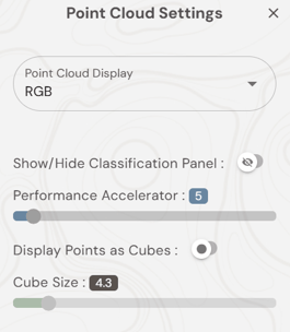
Colour Mode
Other Settings
- Performance Accelerator — lower = denser; raise for large datasets.
- Point Size — adjust cube size for a fuller cloud.
Adjusting Position (Move Tool)
To realign a misplaced layer: in the Layers Panel, click ⋮ on the layer > Move. The layer highlights green — use arrow controls for fine adjustments or Click Move for larger shifts.
Clipping Plane
Open the Panel Button, select Opacity Settings, and then Clipping Plane, then use up/down arrows or type a height value to cut through the model.
What's Next?