
Skip to content
English
  • There are no suggestions because the search field is empty.

Opening a location & viewing the map

Open the Data Viewer to explore your data in 2D and 3D.

Overview

Click any location card from the home screen to open it in the Map Window — Soarvo's interactive 2D/3D map environment for exploring, measuring, and annotating geospatial data.
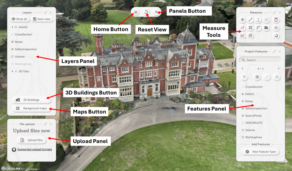
  

Key Panels and Controls
Element
Description
Home Button
Return to the home screen
Reset View
Reset map to starting position
Panel Button
Toggle panel visibility
Layers Panel
Show or hide loaded data layers
File Upload Panel
Upload files and monitor processing 
Background Maps Button
Open the Background Layer picker to switch basemaps, enable Additional Layers, or add WMS sources
3D Buildings Button
Turn On/Off the Google 3D Buildings Layer
Measure Tools
Distance, area, and volume measurements
Project Features Panel
Create and manage feature types; digitise points, lines, and polygons. Includes built-in search.

Background Layer

Click Background maps to open the picker. Choose a basemap (Aerial Imagery, OpenStreetMap Standard/Light, OS Open Data Standard/Light, Black, White), enable Additional Layers with adjustable transparency, or click Add WMS for a custom source.


2D vs 3D Mode
Mode
Best for
2D
Orthomosaics, GIS layers, shapefiles, top-down feature mapping
3D
Point clouds, 3D meshes, terrain, volume measurements

What's Next?
www.soarvo.com